Table of Contents
- Getting Started with TectoTrak: A Game-Changer for Detectorists
- The Core Features of TectoTrak for Metal Detecting
- Enter Go Terrain: An Alternative for New Detectorists
- Comparing TectoTrak and Go Terrain
- Why I Stick with TectoTrak
- The Long-Term Benefits of Using Tracking Apps
- Overcoming Challenges with Tracking Apps
- The Future of Metal Detecting with Tracking Apps
- Conclusion: Embracing Technology in the Quest for History
It was about 19 months ago, when I first decided to give tracking apps a go for my metal detecting hobby. I’d heard whispers about them in online forums and during chats with fellow detectorists, but I’d always been a bit of an old-school searcher, relying on my trusty map and a good memory. Little did I know that this decision would revolutionize my detecting experience and lead to some of my most exciting finds yet.
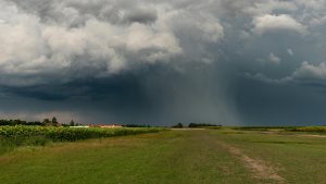
As I pulled up to my favorite detecting spot, a sprawling farm with fields that had yielded everything from Roman coins to Victorian trinkets, I couldn’t help but feel a mix of excitement and skepticism. Would this newfangled technology really make a difference, or was it just another one hit wonder that I would soon forget about?
Getting Started with TectoTrak: A Game-Changer for Detectorists
Before heading out into the field, I’d spent some time researching tracking apps and had settled on TectoTrack. The interface was surprisingly intuitive, even for a tech novice like myself. With a few taps, I’d set up a new project for this detecting session and was ready to go.
As I started my sweep across the field, I quickly realized the first major benefit of using TectoTrak. The app was recording my path in real-time, laying down a coloured line over a satellite view of the land. This feature alone was a game-changer. How many times had I inadvertently re-covered ground I’d already searched, wasting precious detecting time? Or worse, how often had I missed patches, potentially leaving hidden treasures undiscovered? With TectoTrak, these problems became a thing of the past.
The Core Features of TectoTrak for Metal Detecting
But the benefits didn’t stop there. When I unearthed a particularly interesting find – a beautifully preserved Georgian button – I was able to mark the exact location on the map with just a few taps. TectoTrack allowed me to photograph the find, mark its coordinates, and add detailed notes about it. This digital record was far more comprehensive and easily accessible than any paper-based system I’d used before.
One particularly useful feature of TectoTrak is the ability to create individual records for each field or permission. This means I can easily reload the data for a specific area when I revisit it, allowing me to pick up exactly where I left off and ensuring I don’t miss any spots.
Enter Go Terrain: An Alternative for New Detectorists
While I’ve been using TectoTrak for 19 months now and continue to prefer it, it’s worth mentioning that XP has released a fairly similar app called Go Terrain. For anyone new to the hobby, Go Terrain is currently the best alternative available as for now at least, it looks like Tektotrak is no longer available.
Like TectoTrak, Go Terrain allows users to track their detecting path over a satellite view of the land, mark and record finds with photos and notes, and create separate records for different fields or permissions. It’s a solid option for those just starting out in the world of digital detecting.
Comparing TectoTrak and Go Terrain
Both TectoTrak and Go Terrain offer similar core functionalities. They both lay down a colored line over a satellite view of the land, allowing you to see where you’ve walked and where your finds were made. This visual representation of your detecting session is invaluable for ensuring thorough coverage of a site and for planning future visits. You can spot areas that you have missed or go back to refocus on hot spots. You can grid an area or just wander wherever the feeling takes you and you can easily look back to see where you have been. You can even change the colour of the lines for different sessions.
Both apps also allow for detailed recording of finds. You can take photos, mark exact coordinates, and add notes about each discovery. This level of detail is crucial for serious detectorists, whether for personal record-keeping or for reporting finds to local authorities.
The ability to create individual records for each field or permission is another feature shared by both apps. This organizational tool is incredibly useful for those of us who detect across multiple sites, allowing for easy recall of previous sessions and efficient planning of future ones.
Why I Stick with TectoTrak
While both apps are capable tools, I’ve found that TectoTrak suits my needs perfectly. After 19 months of use, I’ve become very familiar with its interface and features. It’s become an integral part of my detecting routine, as essential as my detector itself.
I appreciate TectoTrak’s reliability and the depth of information it allows me to record. The app has helped me build up a comprehensive digital log of my detecting activities, complete with photos, GPS coordinates, and contextual notes for each significant find.
The Long-Term Benefits of Using Tracking Apps
Over the past 19 months, I’ve come to appreciate the long-term benefits of using a tracking app like TectoTrak. It has allowed me to build up a comprehensive record of my detecting activities. I can easily look back at previous sessions, reminding myself of areas that yielded good finds or spots that I meant to return to.
This historical data has proven invaluable in planning my detecting strategy. I’ve been able to identify patterns in my finds, correlating them with specific types of terrain or historical features. This has significantly improved my success rate, leading to more exciting discoveries and a deeper understanding of the history of the areas I detect in.
Overcoming Challenges with Tracking Apps
Of course, it hasn’t all been smooth sailing. As with any technology, there have been a few challenges along the way. In the early days, I often forgot to charge my phone before a detecting session, leading to some frustrating moments when my battery died mid-search. I quickly learned to bring a portable charger as an essential part of my kit.
I’ve also had to adapt to changing weather conditions. Using a smartphone in the rain or with muddy hands can be tricky, and I’ve had to develop new habits to protect my device while still making full use of the app. A waterproof phone case and stylus have become valuable additions to my detecting gear.
The Future of Metal Detecting with Tracking Apps
As I reflect on my 19 months of using TectoTrak, I can’t help but feel excited about the future of metal detecting. These apps have shown me how technology can enhance our hobby, making it more efficient, more systematic, and ultimately more rewarding.
I’m eager to see how tracking apps like TectoTrak and Go Terrain will evolve in the coming years. Will we see integration with other technologies, like augmented reality for visualizing historical landscapes? Or perhaps improved AI for predicting likely locations of finds based on historical data and terrain analysis?
Conclusion: Embracing Technology in the Quest for History
As I pack up my metal detector and gear after another successful day in the fields, my finds pouch a little heavier and my TectoTrak map filled with new data, I can’t help but marvel at how far we’ve come. From the early days of metal detecting with simple machines and paper maps to now, where we have powerful detectors and sophisticated tracking apps at our fingertips.
For anyone considering whether to incorporate a tracking app into their detecting routine, I can only say this: give it a try. There may be a learning curve, and it may change your approach to detecting, but in my experience, the benefits far outweigh any initial challenges. Whether you choose TectoTrack like me, or opt for Go Terrain, these apps can significantly enhance your detecting experience.
So here’s to TectoTrak, Go Terrain, and to embracing new technologies in our quest to uncover the old. Happy hunting, fellow detectorists – may your signals be strong and your finds be plentiful!